
What is a digital twin and how is it built?
What a digital twin is, what it is used for in construction and industry, and how drones, LiDAR and laser scanning turn a site or building into one.
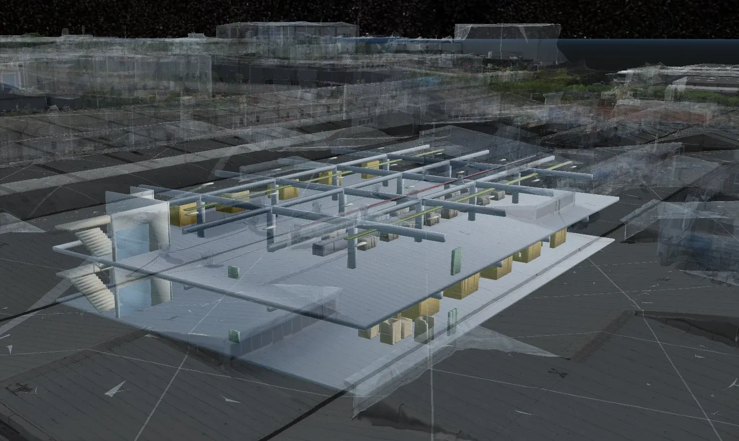
Digital twins come up everywhere today, from construction and manufacturing to cities and energy projects. But what exactly is a digital twin, what is it used for, and how do you build one for a real site? This post explains the idea in plain terms, with examples from our own portal.
What is a digital twin?
A digital twin is a virtual copy of a physical asset (a piece of land, a building, a plant or a machine) built from measured data that you can explore and measure on a computer. Unlike an ordinary 3D visual, it sits in real coordinates and at true scale: a distance, area or volume measured on screen is the same as on site.
A good digital twin is also kept up to date. When the same site is surveyed again at intervals, the twin shows how it has changed.
What is a digital twin used for?
- Construction: cut and fill volumes, progress and as-built checks are measured from the office.
- Industrial sites: buildings, roofs and machine layouts are archived with real dimensions, and new investments or refurbishments are planned on top of them.
- Energy projects: wind and solar sites, access roads and terrain are reviewed in a single model.
- Municipalities: building, road and address data are combined with a 3D city model for planning and inspection.
The biggest gain is being able to decide without travelling to site. Everyone on the team looks at the same, current data.
How is a digital twin built?
A site’s digital twin is built in three steps:
- Data capture. Open areas are captured by drone photogrammetry, ground under vegetation by drone LiDAR, and building interiors and machinery by mobile (SLAM) or terrestrial laser scanners. All data are tied to one coordinate system with ground control points.
- Processing. The raw data become point clouds, orthophotos, 3D mesh models and digital terrain models. Where needed, a BIM model is produced from the scan.
- Publishing. The results are prepared so they open in a web browser, without heavy desktop software, and are shared with the team.
Digital twin vs. BIM: what is the difference?
BIM (building information modelling) describes a building with intelligent elements such as walls, columns and slabs; each element’s type, storey, dimensions and material are known. A digital twin brings that model together with real, measured data from the site.
Existing buildings often have no BIM model at all. In that case the building is laser scanned and the model is created from the scan (scan to BIM). You end up with both the scan that shows reality and an element-based model you can calculate with.
From scan to BIM, step by step
The images below come from a sample factory project in our portal and show the order in which a building’s digital twin is put together.
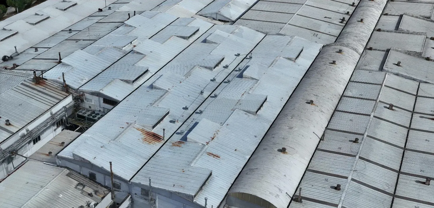
1. An exterior 3D model of the plant is created from drone photos.
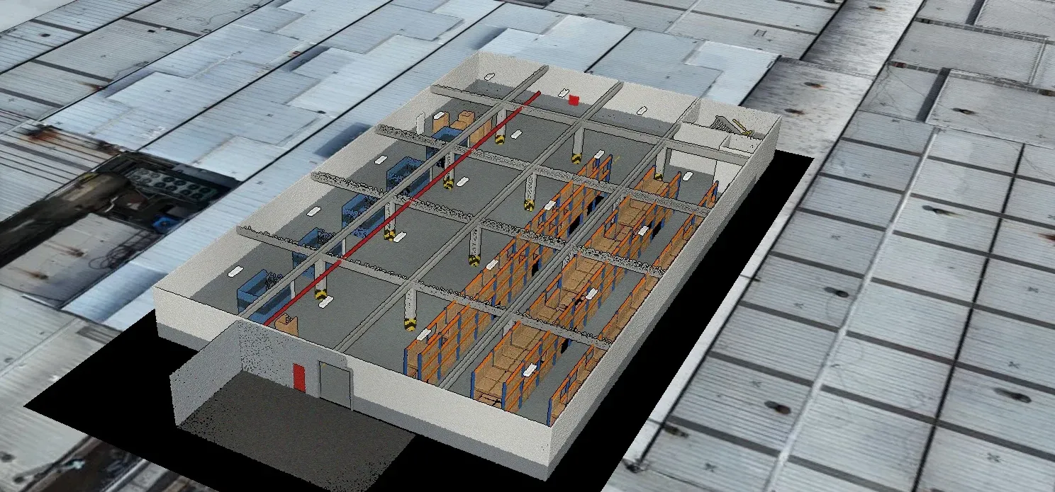
2. The interior is laser scanned and the scan sits inside the exterior model.
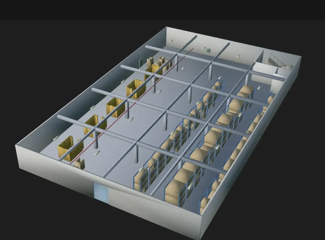
3. A BIM model with walls, columns, beams and equipment is created from the scan. This is the ground floor.
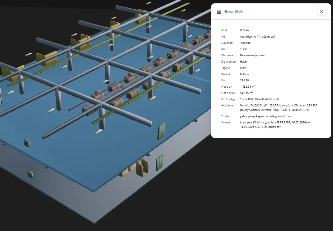
4. Clicking an element shows its type, storey, dimensions, area, volume and whether each value was measured or derived.
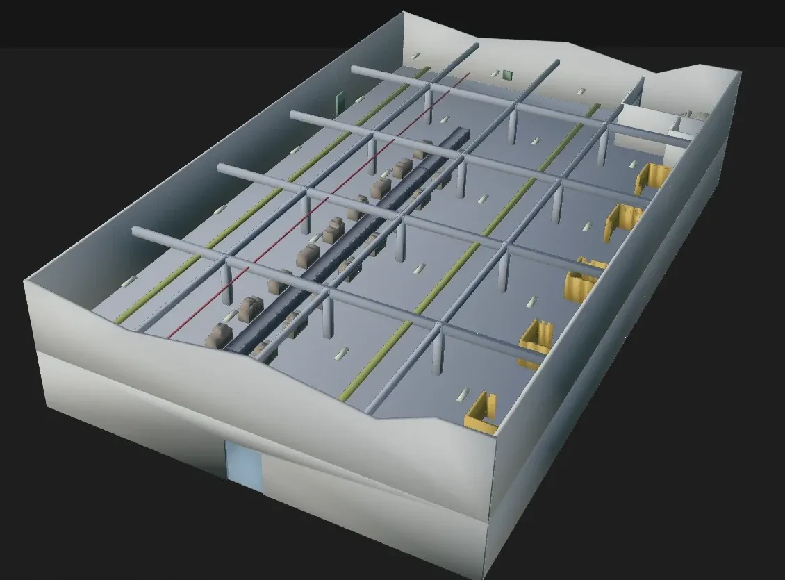
5. Selecting a storey lets you inspect the upper floor on its own.
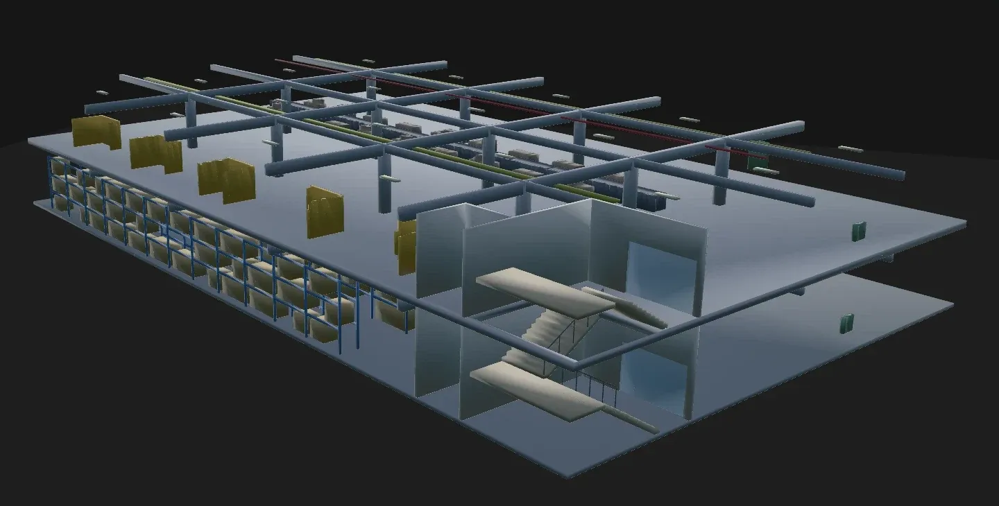
6. With the exterior walls hidden, the stairs and interior rooms come into view.
7. The BIM model is overlaid on the scan for comparison.
Digital twin examples
Much of our field work forms part of a digital twin:
- A quarry volume survey from a drone surface model
- Topographic mapping with stereo restitution for a wind farm
- Drone LiDAR along a vegetated stream corridor
- A 3D model and area survey from oblique flights of an industrial site
MapSurvey Portal: your site’s digital twin in the browser
We deliver our data to clients through MapSurvey Portal. The 3D model, LiDAR point cloud, orthophoto and photorealistic Gaussian splatting model open on one screen. You can measure distances, areas, volumes and sections, compare surveys from different dates, and export drawings as DXF, KML and GeoJSON.
The portal’s BIM & Modeling section opens the IFC model created from the scan. Click an element to see its type, storey, dimensions, area and volume. The model can be overlaid on the scan for comparison, and every value states whether it was measured on site or derived.
Let’s build your site’s digital twin
If you would like a digital twin of your land, building or plant, see our 3D laser scanning, drone mapping and 3D city model services, or simply get in touch.