
Outsourcing Scan-to-BIM: from point cloud to IFC
You scan, we model. A remote workflow from point cloud to BIM model, choosing the right LOD, quality control and delivery through a web portal.
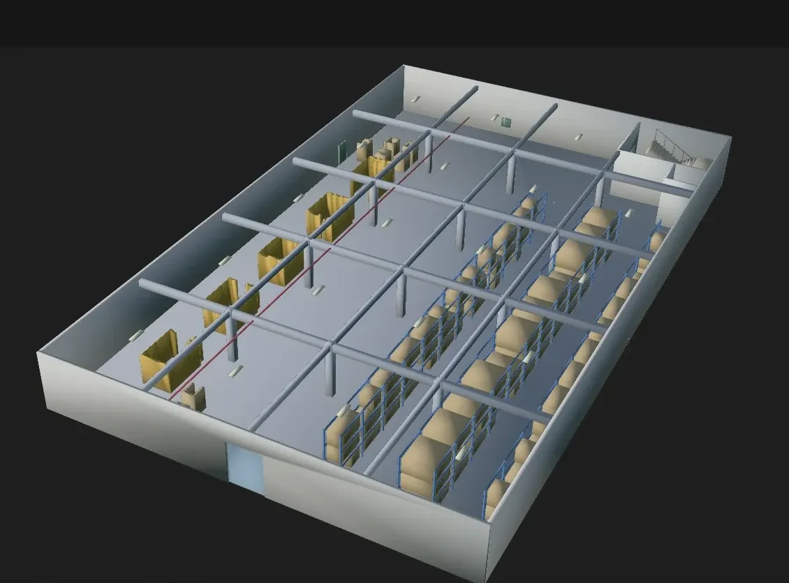
For many surveying firms and architecture practices, the bottleneck is not in the field but at the desk. The scan is done in a day or two; turning that point cloud into a BIM model with walls, slabs, columns and openings takes weeks. Keeping your field crew in the field and outsourcing the modelling is one of the most practical ways to balance the workload.
This article explains how a remote Scan-to-BIM job runs, from the moment you send the point cloud to the moment the model reaches you.
The workflow
- You send the data. A registered point cloud in E57, LAS/LAZ or RCP/RCS format, plus site photos and sketches if available.
- We agree the scope. Which floors and elements are modelled, which LOD, which coordinate system and which naming conventions.
- We model. Walls, slabs, columns, beams, stairs, door and window openings are fitted to the scan.
- We check. The distance between model and scan is measured and deviations are reported per element.
- We deliver. An IFC4 model and a deviation report, plus a portal link where you can review the model in your browser.
What to prepare before you send
- A registered and cleaned point cloud (not raw scan files)
- Coordinate system and height datum
- A simple sketch or list of floors showing the scope
- The client’s information requirements or BIM execution plan, if any
- The delivery date
Which LOD?
The most common question for existing buildings is how detailed the model should be:
| Level | What it contains | When it is enough |
|---|---|---|
| LOD 200 | Approximate geometry, massing and main spaces | Area calculation, early feasibility, layout studies |
| LOD 300 | Dimensioned walls, slabs, columns, beams and openings | Refurbishment design basis, most as-built work |
| LOD 400 | Fabrication-level detail | Rarely needed for existing buildings |
An important note: a scan only measures what is visible. Services inside walls or reinforcement under a slab are not in the scan. In the model we clearly flag whether each element’s values were measured on site or derived, so you know how far you can rely on each part of the model.
Quality control
For every model we deliver, we calculate the distance from the scan points to the model and report the result. With the model overlaid on the scan, you can see how far a wall or column deviates from its real position.
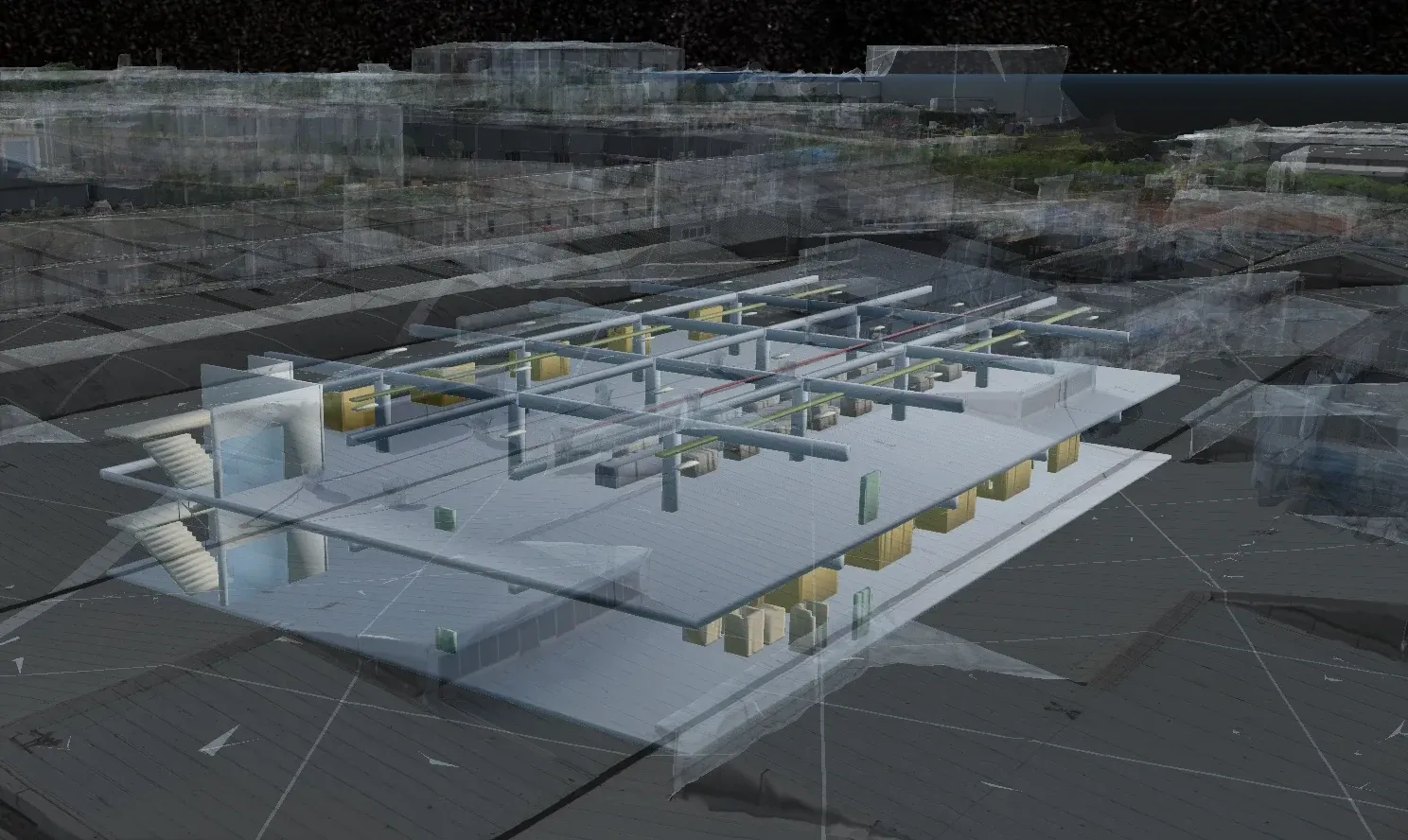
Model and scan overlaid: deviations are also checked visually.
Review in the portal
We do not just email you a file. In MapSurvey Portal the IFC model opens in the browser; click an element to see its type, level, dimensions, area and volume. The model can be overlaid on the scan for comparison. Your client or project team does not need to install any software to review it.
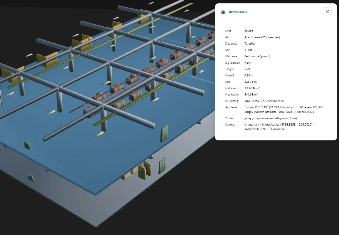
An element’s type, level, dimensions and measurement basis open with a single click in the portal.
What remote work looks like in practice
Turkey is one to two hours ahead of Central European time, so working days largely overlap and questions are answered the same day. We transfer data using the method you prefer, and your data is processed for your project only.
Start with a pilot
For a first collaboration we usually suggest starting with a single floor or a small building, so we can agree the level of detail and delivery format together. See our 3D laser scanning service, follow the Scan-to-BIM steps in our digital twin article, or simply get in touch.